High accuracy mapping for planning, design, engineering & construction.
Our topographical surveying services provide detailed, precise, and reliable mapping of natural and built environments. Using modern total stations, GNSS, 3D laser scanning, UAV photogrammetry, and digital workflows, we capture the critical spatial information needed for design development, planning applications, engineering works, and asset management.
A topographical survey forms the foundation of many projects. We map all visible features — boundaries, structures, vegetation, utilities, levels, surfaces, elevations, and terrain — to produce a clear and accurate representation of your site.
Our surveys are tailored to your required specification, whether for high accuracy engineering design or broader planning and feasibility work.
Our survey process includes:
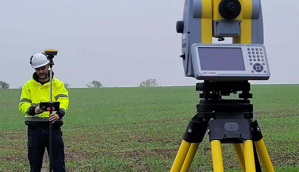
Installation of GNSS or total station control networks to ensure survey accuracy and repeatability.
Using a combination of robotic total stations, GNSS receivers, 3D laser scanners and UAV capture where appropriate.
Including buildings, boundaries, kerbs, drainage features, utility covers, vegetation, surfacing, structures, and all visible detail.
Creation of 2D & 3D models including contours, spot levels, and breaklines for engineering or design workflows.
CAD, PDF, BIM ready models, point clouds, orthophotos, and GIS formats supplied to meet your preferred standards.
Assessment of project requirements, specifications, and accuracy standards. Establishing control, methodology, and equipment selection.
High precision GNSS, total station, laser scanning, and UAV techniques deployed to gather complete, coordinated site data.
Post processing, QA checks, and creation of 2D/3D outputs to ensure clarity, accuracy, and consistency.
Drawings, models, and datasets delivered in your preferred format (DWG, DXF, PDF, RVT, LAS, XYZ, SHP, etc.).
High precision instrumentation and controlled workflows ensure dependable data for design teams.
Streamlined capture and processing deliver surveys quickly without compromising quality.
Accurate early stage data reduces costly design, planning, and construction errors.
Specifications adapted to suit architects, engineers, planners, utilities, and contractors.
Topographical and mixed discipline surveys completed by our leadership team across the UK.
Professional technical experience in topographical, utility & infrastructure surveying.
Capability in GNSS, total station, UAV, 3D scanning & digital modelling.
We combine technical expertise, modern instrumentation, and a commitment to clear communication to deliver topographical surveys that support confident decision making. Our experience spans small residential plots to large scale infrastructure, allowing us to adapt methodology and accuracy to meet any project requirement.
Whether you’re designing, planning, or constructing, we provide the data you need — precise, reliable, and on time.